Satellite Soil Analysis and Nutrient Mapping by Siora
October 12, 2025
Note: this is a summary of the original post, condensed for this rebuild rather than reproduced word for word.
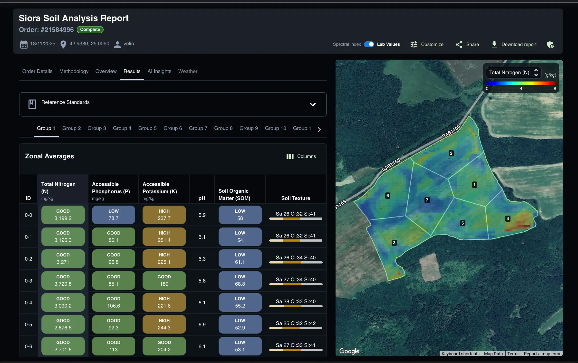
Precision agriculture starts with the soil — nutrient availability, texture, organic matter, and pH shape how efficiently every other input performs. Siora treats soil intelligence as that foundational layer, mapping nutrients and physical properties at high resolution so fertilization, irrigation, and rotation decisions can be made on real data rather than guesswork.
Correcting for moisture with radar
Optical satellite imagery reads reflected sunlight, and surface moisture can distort that signal. Siora pairs it with Synthetic Aperture Radar (SAR) data, which reacts to moisture differently, to correct for that distortion — it doesn't remove moisture's influence entirely, but it substantially cuts the uncertainty versus using optical data alone. Additional image processing suppresses noise, atmospheric interference, and roughness scattering to keep the reflectance signal clean.
Reading soil in its environmental context
Soil doesn't form in isolation — geology, topography, and climate all shape it. Siora feeds the model auxiliary context alongside the spectral data: parent material and geological age, local climate and weather, hydrological indices like the Topographic Wetness Index, and soil texture and temperature. That context is what lets the model tell apart soils that look similar spectrally but behave very differently — a sandy soil and a loamy soil can reflect light almost identically while holding water and nutrients in completely different ways.
Reading the season, not just the moment
Beyond static soil signals, Siora analyzes time-series imagery from prior growing seasons to extract a phenological signature — how the crop developed and where it showed stress across the season. Crop stress has more than one cause, but this seasonal context adds a useful signal for interpreting nutrient imbalances alongside everything else.
Keeping predictions chemically realistic
Soil spectroscopy has an inherent ambiguity problem: different nutrient deficiencies can produce similar reflectance signatures. Siora addresses this with a physics- and chemistry-informed loss function that encodes known relationships between properties like pH, cation exchange capacity, clay, and sand content and how nutrients behave and compete. Because pH and CEC are reliably detectable even at moderate resolution, they act as stable anchors that keep the model's output physically plausible rather than letting it drift toward chemically inconsistent answers when data is sparse or noisy.
Where the data sources meet
Combining radar, optical imagery, environmental context, and physics-informed learning is what lets Siora's nutrient estimates track real-world soil conditions closely enough to be useful in the field — interpretable results that help move soil management from visual observation toward actual data.
Ongoing validation
Siora continuously checks its output against real field data, and results across several European regions have lined up well with local soil sampling. As testing expands to other continents, the team is looking to collaborate with agricultural professionals, research institutions, and input suppliers — diverse benchmark samples help surface regional nuances and sharpen local accuracy. Anyone interested in testing the system can get in touch via the Siora contact page, or browse theOpen Soil Datasets to see sample output first.