Open Soil Datasets – Free Soil Nutrient Maps
Siora is committed to advancing global soil knowledge through open, freely available datasets. Our satellite-derived soil nutrient maps, generated through our platform, give farmers, agronomists, researchers, and developers access to accurate, scalable soil data, without the delays and costs of physical sampling.
All datasets are released under the Creative Commons Attribution (CC-BY 4.0) license, making them free to use for research, education, and application in precision agriculture.
Open Data
Why We Publish Open Data
Open access to reliable soil data supports innovation in agriculture, climate monitoring, and environmental science. By sharing datasets openly, we aim to:
- Support reproducible research in soil science and remote sensing
- Enable better fertilizer planning and nutrient management
- Provide benchmark data for method validation and reproducible research
- Help farmers and agronomists make informed, data-driven decisions
Available Datasets
Available Datasets
Below is our growing collection of open datasets. Each dataset includes nutrient maps, styled heatmaps, metadata, and licensing information. If you're interested in a new dataset, please contact us.
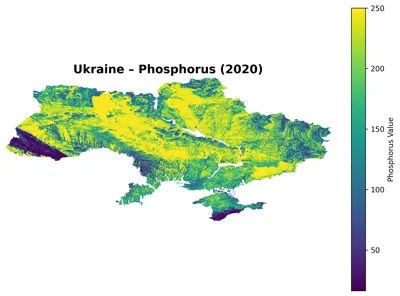
Ukraine Soil Nutrient Maps
Satellite-derived maps of N, P, K, OC, and pH for Ukraine at 250 m resolution for 2000, 2010, and 2020.
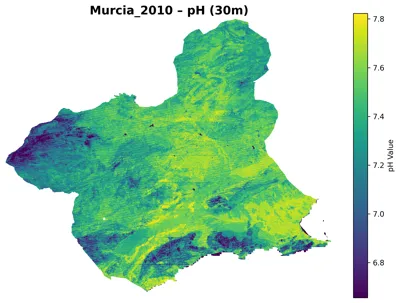
Murcia Soil Nutrient Maps
30 m resolution satellite-derived maps of N, P, K, OC, and pH for Spain's Murcia region for 2000, 2010, and 2020.
Package Contents
What's Inside Each Dataset
Every dataset is packaged to make it immediately usable for analysis or integration:
- ✓LICENSE.txt (CC-BY 4.0)
- ✓Single-band GeoTIFF for each nutrient (machine-readable, GIS-ready)
- ✓Styled PNG heatmap for quick visualization
- ✓Thumbnail image for previews and galleries
- ✓README.md with full methodology and usage notes
- ✓Metadata JSON for programmatic access
Methodology
Methodology Summary
Our soil nutrient maps are produced using satellite-based reflectance spectroscopy, enhanced with topographic, climate, geological, and weather data. This auxiliary data is used to reduce noise in the spectral signal, enabling precise detection of soil nutrient spectral signatures.
We calibrate our models against established laboratory extraction methods to ensure comparability.
| Parameter | Standard |
|---|---|
| pH | ISO 10390:2005 (Glass electrode method) |
| Nitrogen | ISO 11261:1995 (Modified Kjeldahl) |
| Phosphorus | ISO 11263:1994 (Spectrometric determination) |
| Potassium | USDA–NRCS (Atomic absorption after NH₄OAc extraction) |
| Organic Carbon | ISO 10694:1995 (Dry combustion) |
Stay Updated